In the last installment we ended up on Polyanna Avenue, where certain urbanists always live despite constantly being wrong.
The pictures in this post come from the commute home on Wednesday October 8th (and I went back and filled some images in the first section as well, taken on this same day).
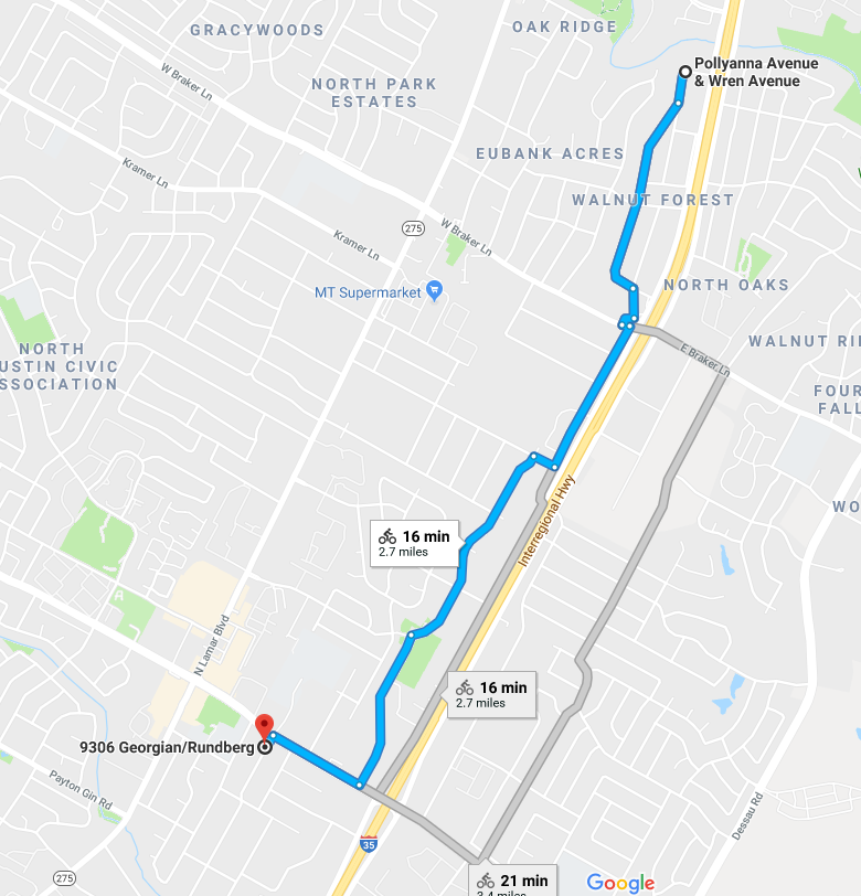
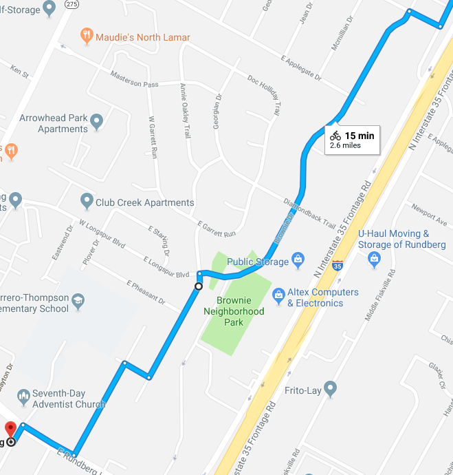
Now for the next bit. Heading from north to south; you basically need to get from Walnut Creek across Braker Lane and your endpoint should be Georgian at Rundberg (Georgian, give or take, is the start of the long bike route that turns into the two lane part of Guadalupe).
Here’s what Google recommends as the route for the whole section.
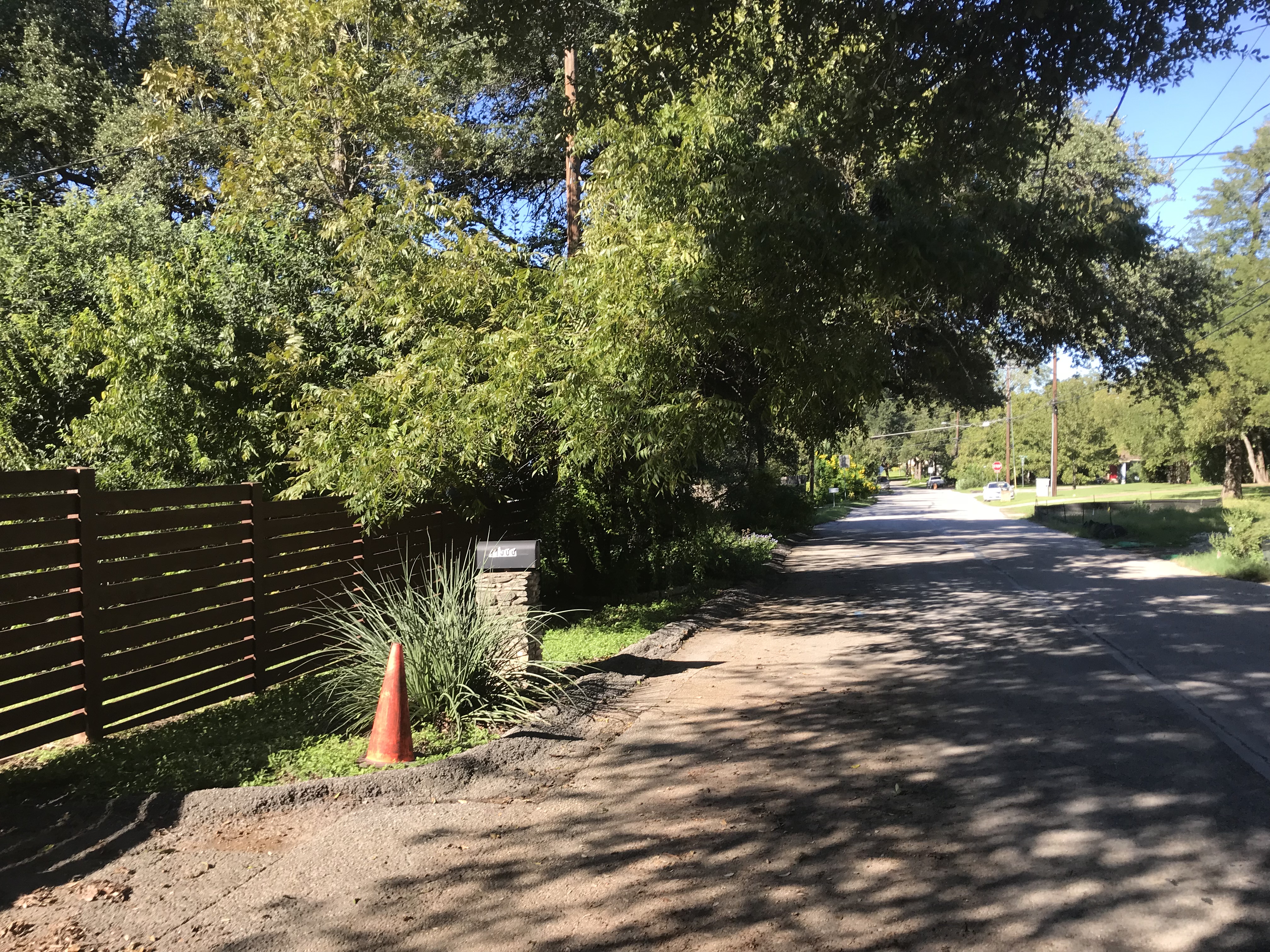
The northern part of this route matches Google’s recommendations. Whitewing is a nice slow uphill with plenty of shade and interesting houses to look at. Must have been a nice place at some point before the I-35 noise got to where it is now. Then, you end up having to take a sharp left, pedal a short deathly uphill (I’m a wimp for hills), to get to the final bit of Polyanna that takes you to Braker. Here’s some shots along the way…


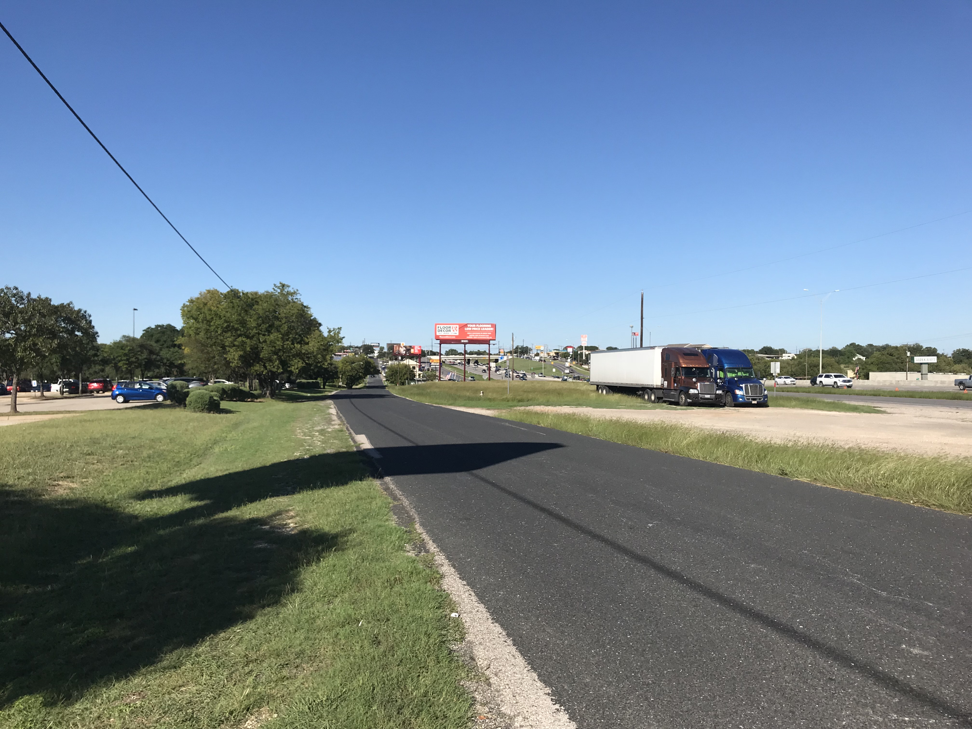
Crossing Braker is not a joyful experience. You need to get to the other side and start on Middle Fiskville Road, which is 100 feet or so west of the I-35 frontage road. You have two options here; either go to the frontage road and cross there (if you decide to cross there, do it as a pedestrian and then you have to do some sidewalk riding to get back west), or wait for a break in traffic and cut across to the median opening, then wait until the rush hour traffic completely stops and wind through the cars to the bike lane and use it for about 50 feet east. This actually worked out better than the frontage road option as it didn’t require any sidewalk riding but YMMV. Without the rush hour stoppage of the cars I think the pedestrian option is better.

Then you get a brief fast run down Middle Fiskville Road, parallel and close to I-35. Wave at me as you drive. This is OK except on most days you’re gonna lose most of your velocity to a headwind and have to go to granny gear to finish the uphill (again I’m a baby on hills). Right turn on Grady Dr, left turn on Brownie Dr, usually cars in the way that prevent an easy transition here.

Brownie is a downhill through areas that are the ANC’s stereotypical density nightmare (car-dependent fourplexes that have gone to pot). Still better than riding up north though. Frustratingly, you lose the ability to coast on a downhill due to a dumbass 4-way stop (this happens a lot more later). No pictures here.
Then, Google fails you. The recommended route has you going through “Brownie Neighborhood Park” which doesn’t really exist. Instead there’s a road which heads to a closed and locked gate for the charter school that took over the old Showplace Lanes bowling alley. No way through here; backtrack and ask how much you paid for these directions.
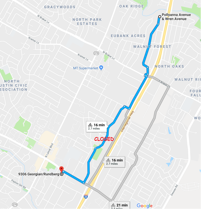

Instead, you have to continue and turn on Oriole, and I was prepared to run THIS route based on pre-exploring the route in my company car previously:
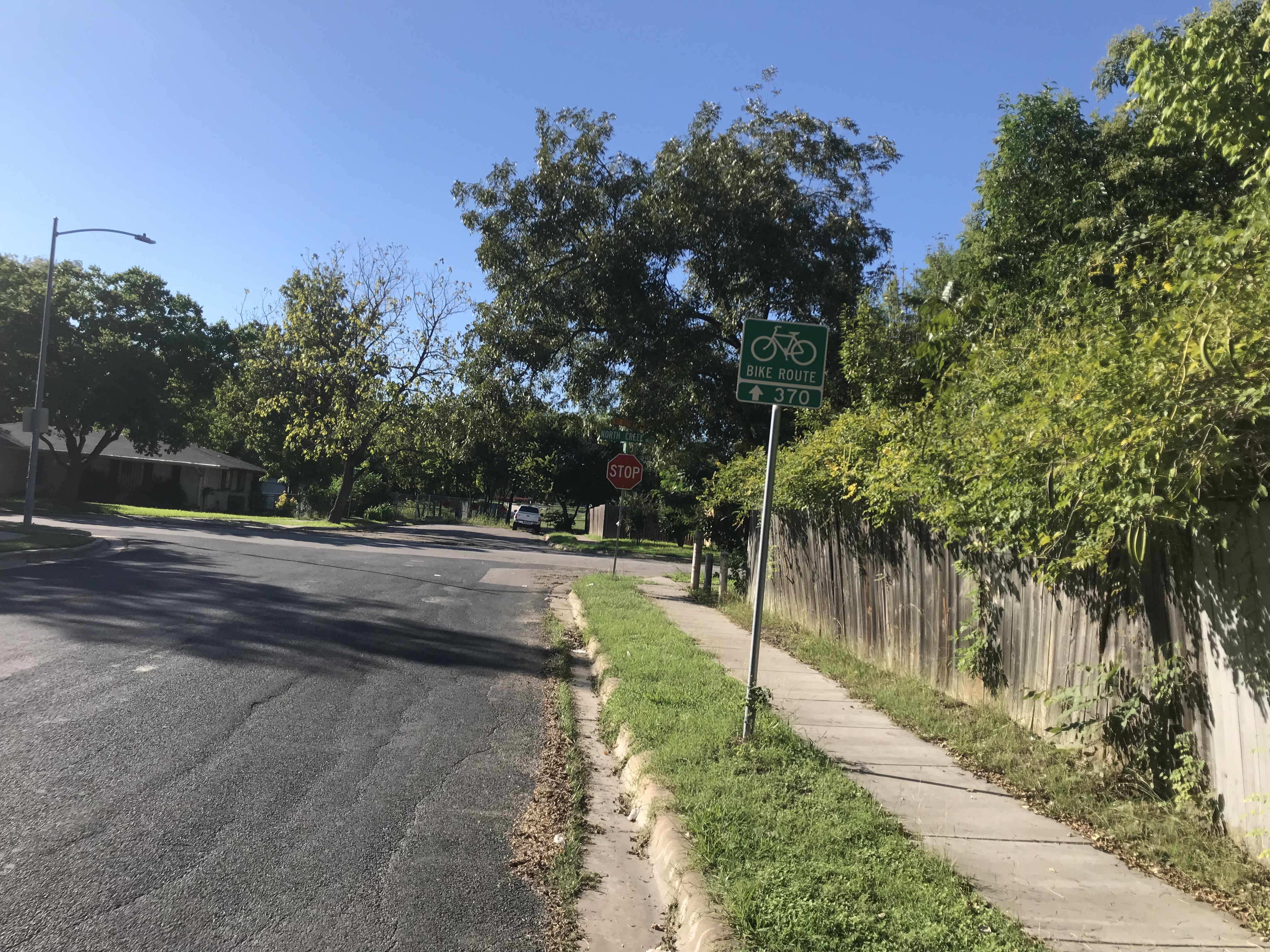
Oddly enough, when on the bike, you instead get recommended Route 370 in the city bike network, which requires a short stub of sidewalk + grass into Walnut Creek Elementary. (I have no idea why the desktop directions don’t let you do this; I’ve helpfully drawn the difference; but I will eventually try the Google route as honestly the Rundberg traffic heading west in the afternoon isn’t too bad to scare me away from a right turn and a quick move to the left turn lane, just haven’t tried it yet).
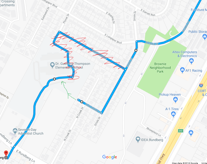
The elementary school is likely locked up most of the school day, so this is not an option unless you are going home about when I did both times so far (about 4:45 by this point). Short section where you are like “thanks for routing me in the mud and grass and hope I didn’t take a road bike, google and the City of Austin bike route map”, and then you end up on the road that turns into Georgian. Aaaah.


Last sections later this week.